
This winter, you can escape the daily grind and unwind in nature. The days might be getting shorter, but don’t rush to pack away your hiking boots. Getting out into nature in the crisp, clear days of winter is invigorating in a whole new way. Grab your coat, your beanie and a friend or three, and stride into our parks where you will find a variety of scenic walks that are well sign posted.
Everyone knows about the fabulous wines of Victoria’s Pyrenees Region, but the state and national parks really are the region’s best kept secrets. They’re easily accessible and simply beautiful.
Mount Cole and Mount Buangor Parks and Pyrenees State Forest are located just 1 hour out of Ballarat and are filled with lush green rainforests with stunning views, fern filled gullies and offer scenic walking trails that are dwarfed by giant ferns and towering trees.
Here are just a few of our favourites:
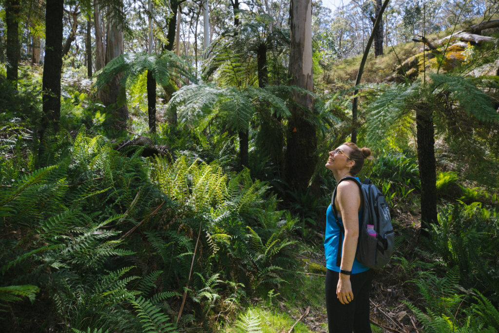
The 21km Beeripmo Walk takes you through lush green landscape, around huge majestic trees, waterfalls and viewing areas. The Beeripmo Walk starts off from Richards Campground in Mount Cole, winding through a myriad of vegetation and changing landscapes. The trail begins gently but climbs quickly with the landscape changing from woodlands to fern and moss covered rocks. The trail will take you to the top of Cave Hill and then Mugwamp Hill where you will find breathtaking views across to Mt Langhi Ghiran and the Grampians before heading down again.
For those of you who want a shorter dose of nature, the Raglans Falls Hutchings Track Loop is an 8.25km walk that starts at Richards Campground and takes you up a steep hill via the Raglan Falls with steep mainly downhill return. This walk provides great views over the Raglan area.
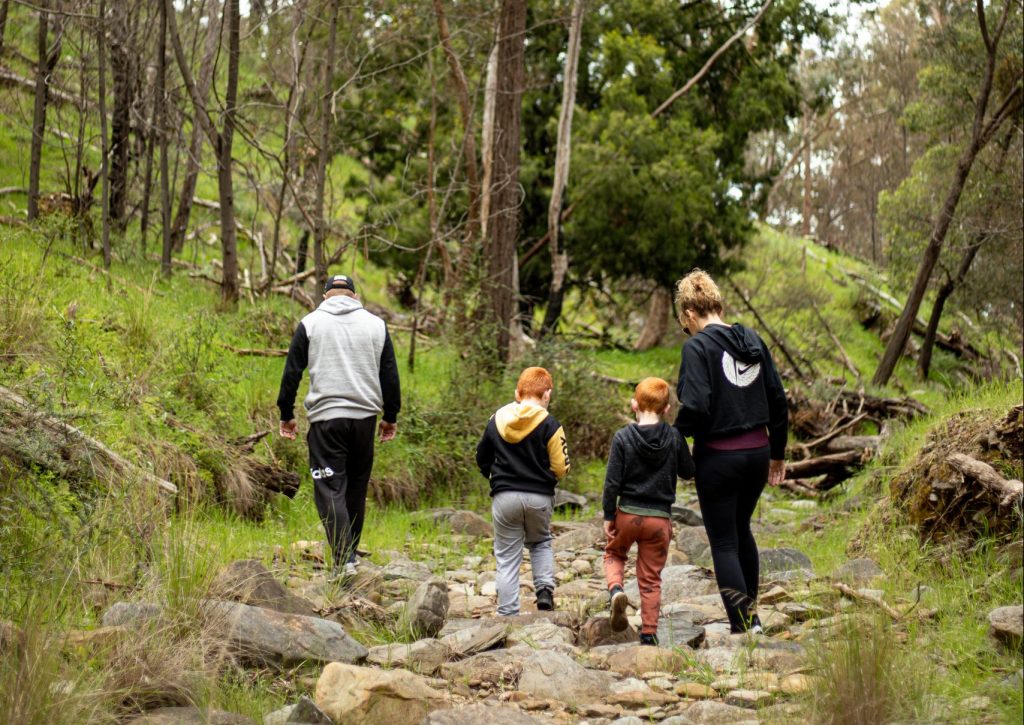
One of the favourite walks for families is the Fern Tree Waterfalls Nature Walk located in the Mount Buangor State Park accessed from the Western Highway via Ferntree Gully Road. Nestled in a beautiful forest setting and beginning at Ferntree Picnic area, the 1km track weaves through lush ferns and over bridges before descending to the beautiful falls.
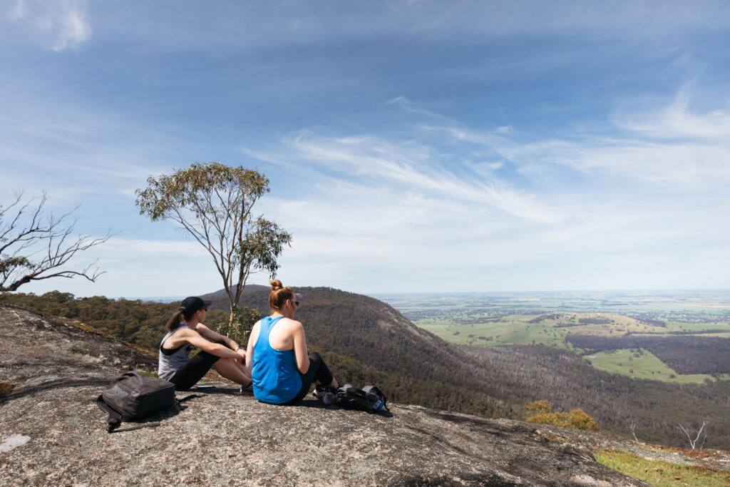
The Sugarloaf Walk in Mount Buangor is a scenic 9km walk that has a number of scenic photo-worthy lookouts. Starting from Ferntree Falls Picnic Ground, this walk is generally considered a challenging route with rocky and steep sections of the walk. This hike also takes in Buckertillible Cave which is not a sleeping cave, but a spectacular granite formation. Buckertillible is the Aborigine name for a large rock overhang.
Middle Creek Cave Hill Track is an interesting 6.5km walk that starts at Middle Creek Campground and takes you through a variety of vegetation from fern gullys to native bushland. You will find yourself at the Cave overhang where you will need to scramble over the rocks until you reach a large rock face which has a chain to help you cross. This is a great walk for people who like to have a bit of adventure!
Avoca Waterfall Walk is located in the Pyrenees State Forest and is a scenic stroll alongside a stony creek to the gorgeous Avoca Falls, a seasonal waterfall which is nestled in a valley within the Pyrenees State Forest. Accessed via an easy 500 m walk from the nearby Waterfalls Campground, Avoca Falls is a great place to explore.
This waterfall typically only flows after heavy rains which is why winter is the perfect time of year to explore this walk.
The 500m walking track is narrow and uneven in places, travelling upstream along Number Two Creek. This creek is seasonal, but the walk is scenic with or without water flowing.
Governors Rock Lookout and Picnic Area is located on the No2 Creek Track in Percydale in the Pyrenees State Forest. The track to the lookout is a gravel road and quite windey but still suitable for 2wd vehicles. The road runs alongside a sharp drop off, so drive carefully.
From the car park, it is a 200m walk up to the lookout tower – a tall platform with steel steps and railing which offers spectacular views of hills, bushland and farmland. You can extend your walk along the walking track which will meet up again with No2 Creek Track, and you can follow the road back up to the picnic area.
For Park Maps and more walks, got to https://visitpyrenees.com.au/things-to-do/walk-and-hikes/